My day on Twitter didn’t start out too well today. I wrote this:
Experience on twitter is bimodal.
Some days, you learn so much. On others, there's hardly any value, only random outrage and negativity.
Perfect example of "uncertain rewards", as @nireyal calls it. No wonder it's so addictive.
— Karthik S (@karthiks) July 31, 2021
As I’ve stayed on for longer, with more data, things have improved today. I’ve learnt a few things, had a few conversations, and watched some fights. But so far, my day has been made by this article about Bangalore’s topography and development.
I’m halfway through reading it, so can’t say yet if I can agree with its conclusions. But what I really really like about the article is the maps. The main map they have is a topographical map of Bangalore (unfortunately, focusses on the cantonment area, so my areas are left out), and then zooming in to bits to explore development.
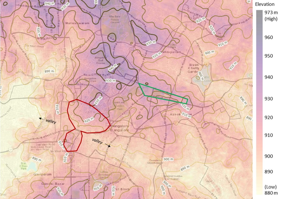
So many insights already from this:
- There is a clear correlation between areas that are perceived to be “posh” and elevation. The better planned areas of Bangalore are built on higher ground than the worse planned.
- “High grounds” lives up to its name
- While the article (so far) is mainly about construction of the cantonment, the preference for high areas post independence is also evident. From the bottom of the map seen above, you can broadly identify the northern boundary of the area that is now Jayanagar and Basavanagudi. Similarly, the Vidhana Soudha is built at pretty much the highest part of Bangalore (before the Metro came up, you could see the Vidhana Soudha by standing on top of the Trinity Church spire)
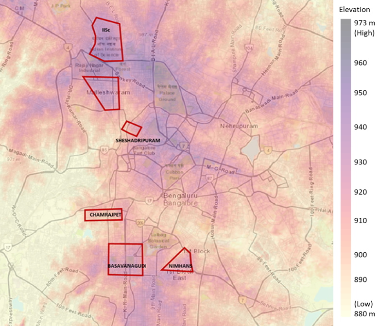
Later on in the article there is a more zoomed-out map of Bangalore. And that confirms that Jayanagar is indeed on lofty land.
Progressing in the article, and it goes off into the (not unexpected) caste and class conflict territory. In any case, I’ve got my value from it. These maps are absolutely fascinating! I hope you like them as well